The national Historical Ecosystems/Vegetation Map was recently updated on the Geospatial Platform of the FNDS MRV Unit. The map was developed by the Wildlife Conservation Society (WCS), with the collaboration of a multidisciplinary team.
From 2019 to 2023, UMRV was part of a team of environmental and conservation experts having played an important role in mapping Mozambique’s ecosystems with an unprecedented level of detail. The result of this effort is a historical map that identifies 162 vegetation units on a scale of 1:250,000. In addition, the first national assessment of the Red List of Ecosystems was conducted, following the methodology of the International Union for Conservation of Nature (IUCN).
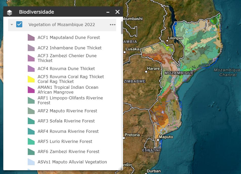
The present map of vegetation/ historical ecosystems is available in the geoportal of the MRV Unit and on the SIBMOZ website thus offering access to the public for a wealth of information on Mozambican biodiversity, as a valuable tool for the conservation and sustainable management of the country’s natural resources.
For more details, visit the UMRV Page from this link:
https://www.fnds.gov.mz/mrv/